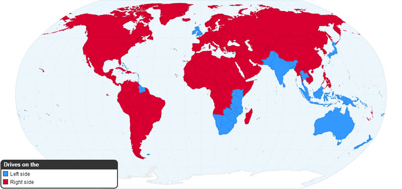
Ever wonder which side of the road different parts of the world drive on? How about what Pangea would look like with today’s international borders? What about where the TV remote is located? Well, this post has the answer to the first two questions and more–and they’re all in map form. For the remote, just check under the couch again. Check out these maps and see if things make more sense to you!
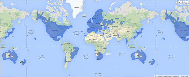
1.) Where Google Street View is Available
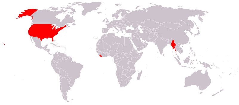
2.) Countries That Do Not Use the Metric System
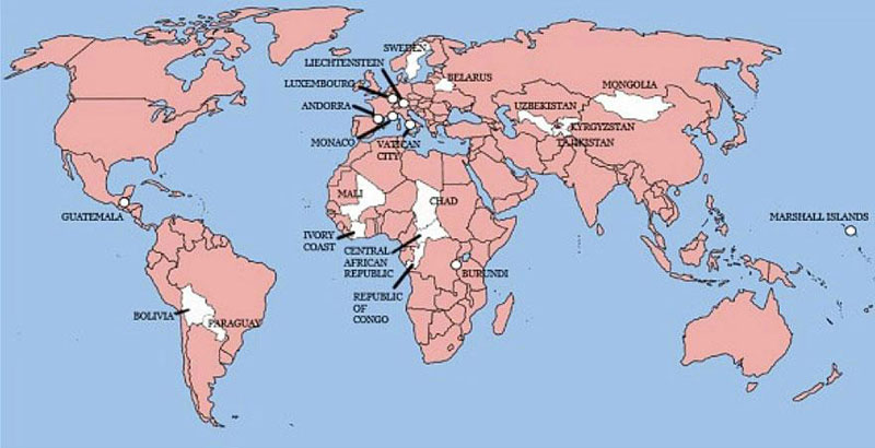
3.) The Only 22 Countries in the World Britain Has Not Invaded (not shown: Sao Tome and Principe)
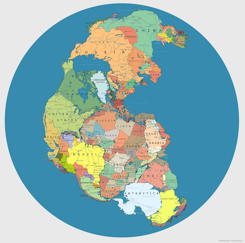
4.) Map of ‘Pangea’ with Current International Borders
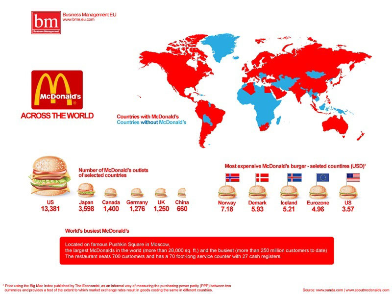
5.) McDonald’s Across the World
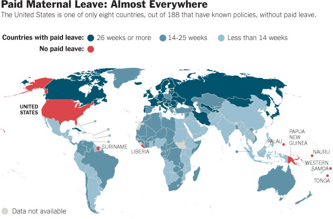
6.) Paid Maternal Leave Around the World
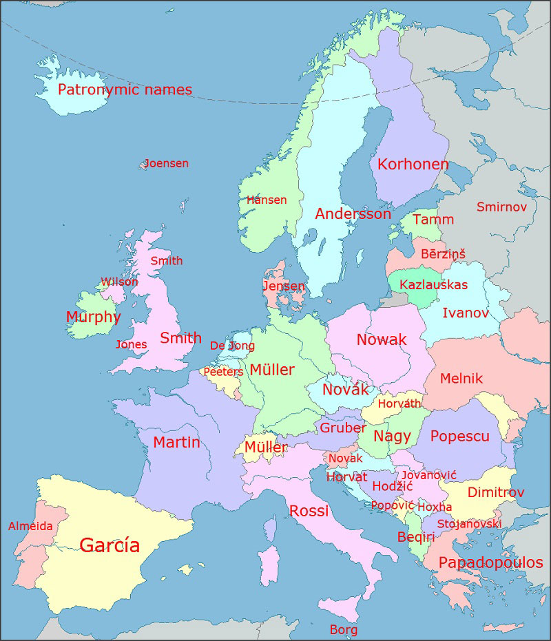
7.) The Most Common Surnames in Europe by Country
8.) Worldwide Driving Orientation by Country
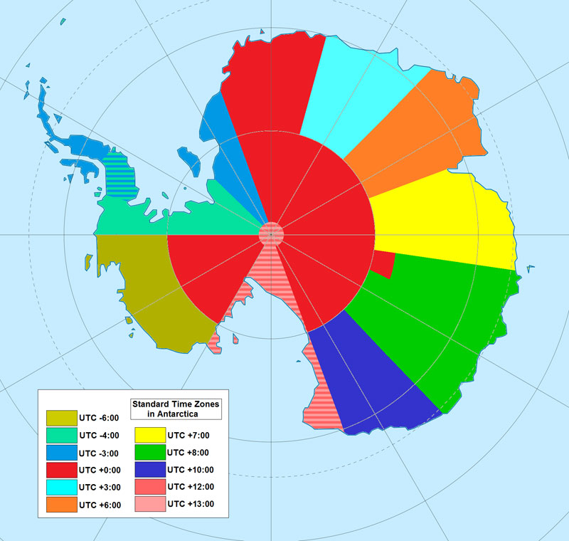
9.) Map of Time Zones in Antarctica
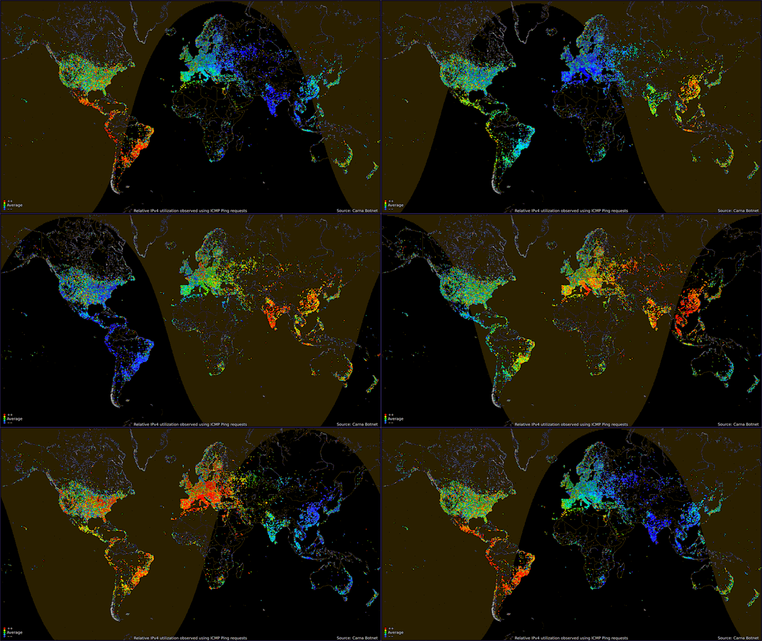
10.) Global Internet Usage Based on Time of Day
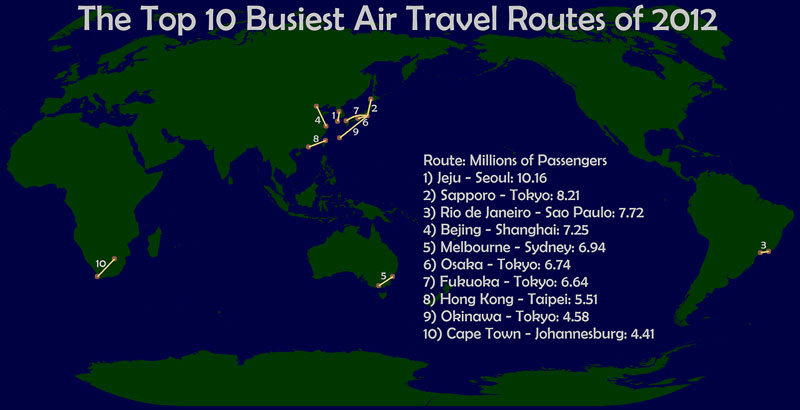
11.) The World’s Busiest Air Routes in 2012
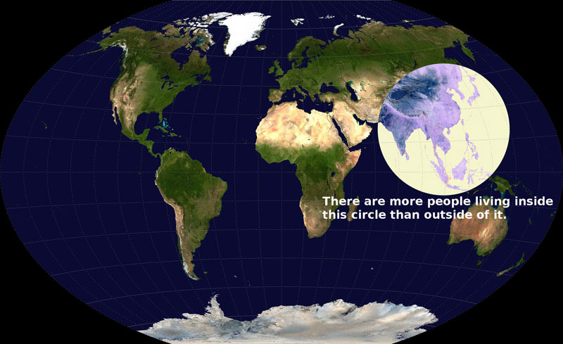
12.) Global Population Density
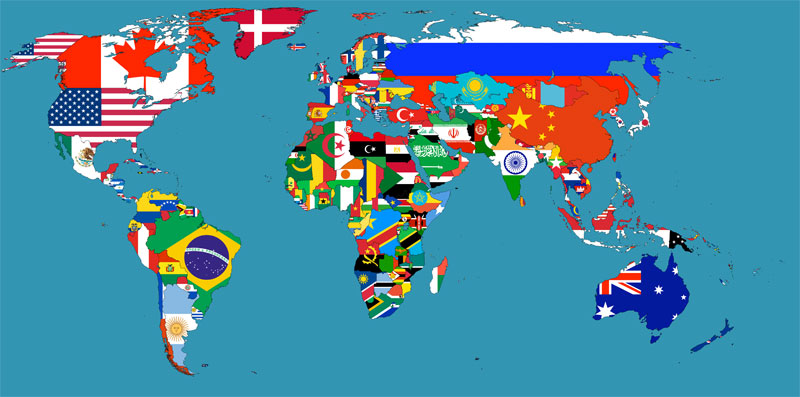
13.) Flag Map of the World
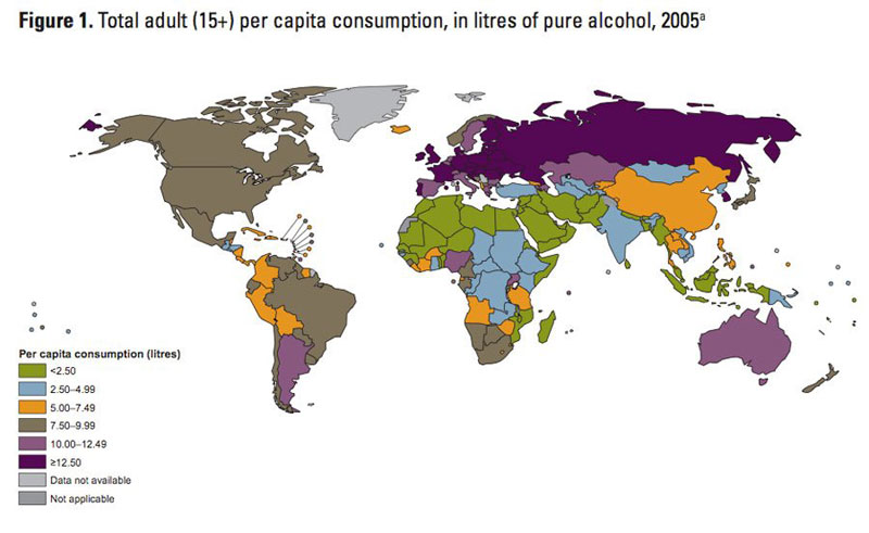
14.) Map of Alcohol Consumption Around the World
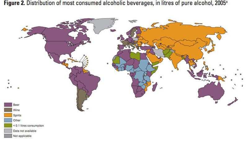
15.) Map of Alcoholic Drink Popularity by Country
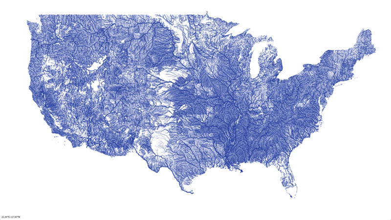
16.) Map of Rivers in the Contiguous United States
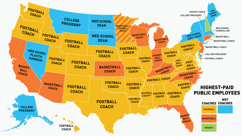
17.) US Map of the Highest Paid Public Employees by State
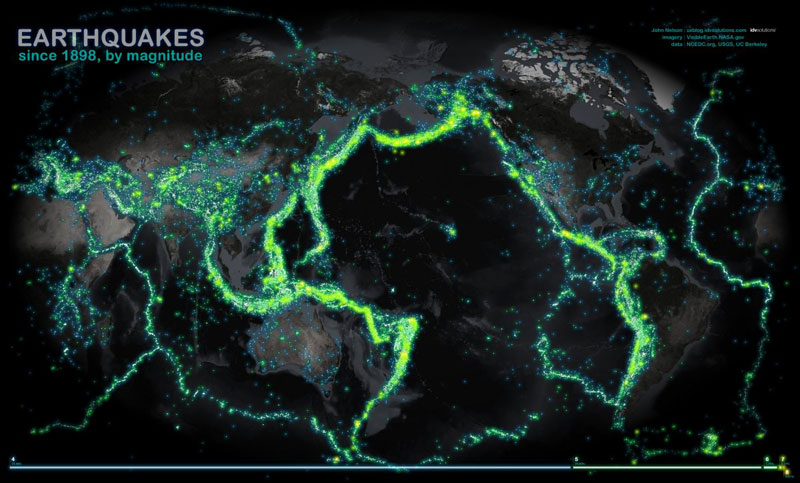
18.) World Map of Earthquakes Since 1898
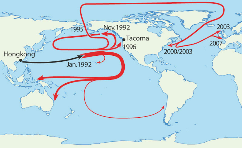
19.) Map of Where 29,000 Rubber Duckies Made Landfall After Falling off a Cargo Ship in the Middle of the Pacific Ocean
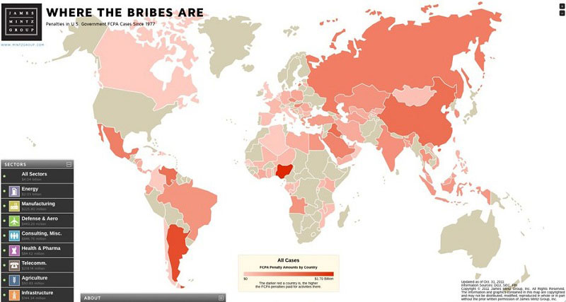
20.) Map of Countries with the Most Violations of Bribery
