Urban decay is a problem all over the United States, that has only gotten worse since the 2008 – 2009 financial crisis. It’s so bad some parts of the country are on the verge of being swallowed by it entirely. However in no place is urban decay more prevalent than in the motor city, Detroit.
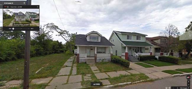
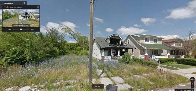
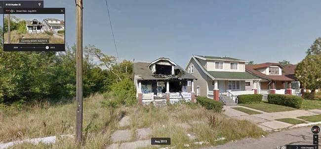
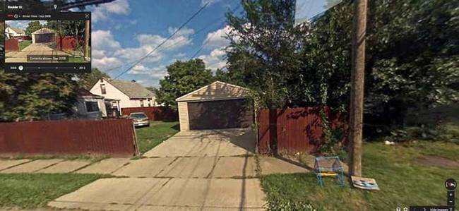
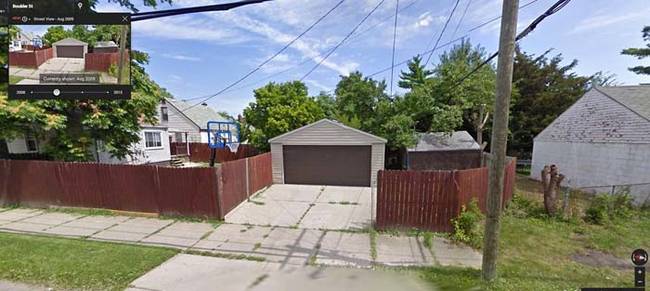
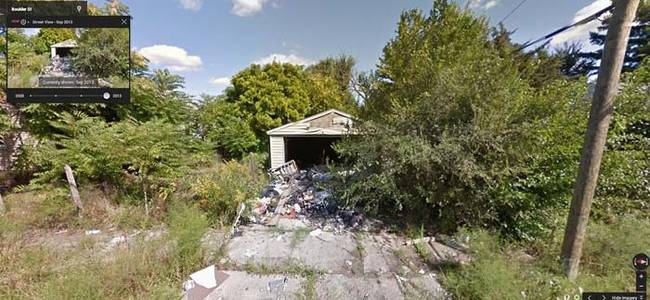
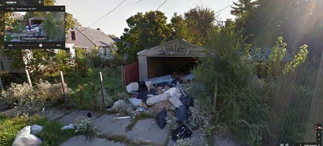
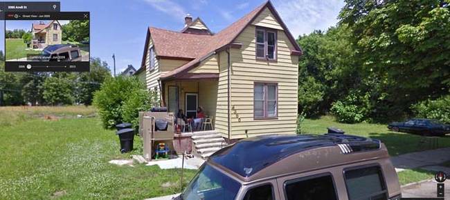
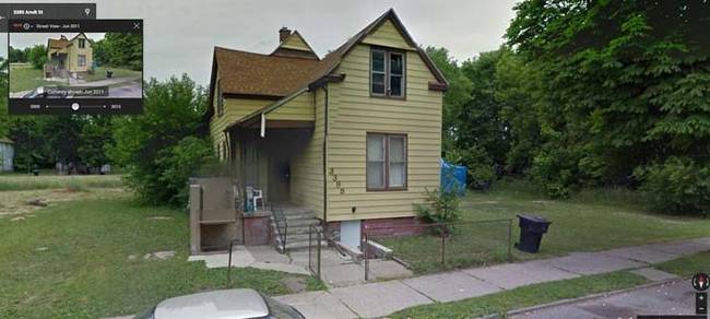
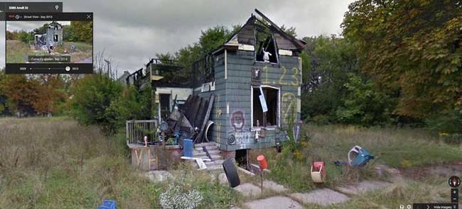
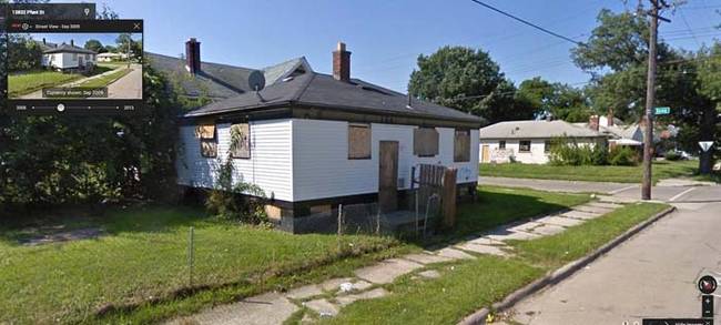
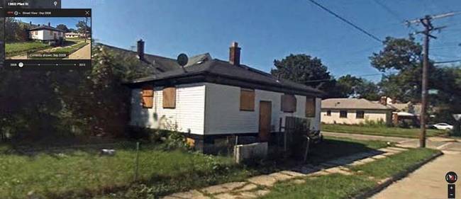
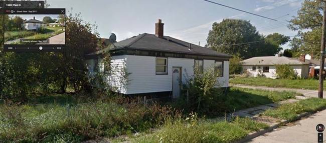
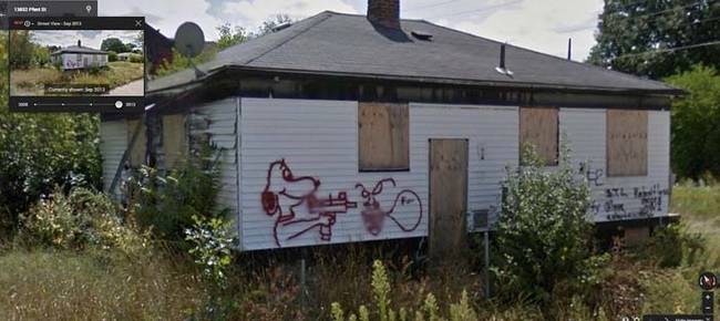
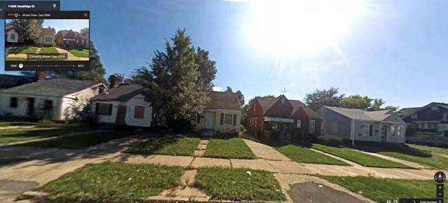
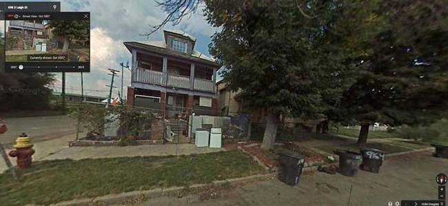
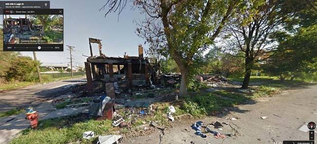
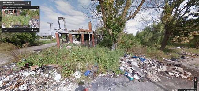
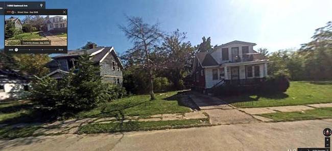
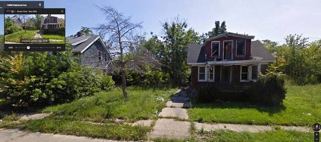
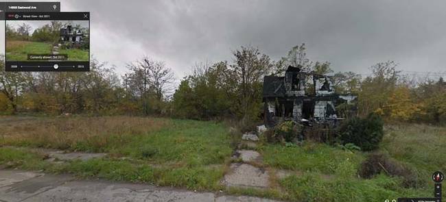
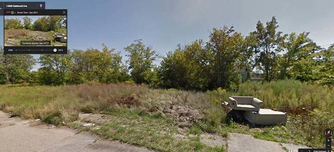
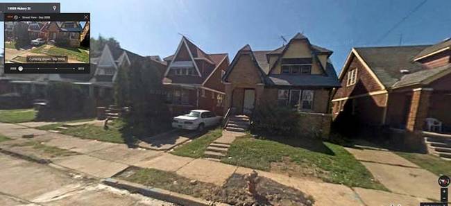
Before, urban decay was a slow process that really only the people who lived there could see happening. Now, anyone can chart the progress of urban decay using Google Maps by comparing pictures of neighborhoods taken in different years. Just take a look.
Bryden Street – 2009.
Bryden Street – 2011.
Bryden Street – 2013.
Boulder Street – 2008.
Boulder Street – 2009.
Boulder Street – 2011.
Boulder Street – 2013.
Arndt Street – 2009.
Arndt Street – 2011.
Arndt Street – 2013.
Pfent Street – 2008.
Pfent Street – 2009.
Pfent Street – 2011.
Pfent Street – 2013.
Hazelridge Street – 2008.
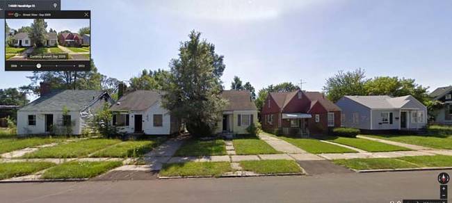
Hazelridge Street – 2009.
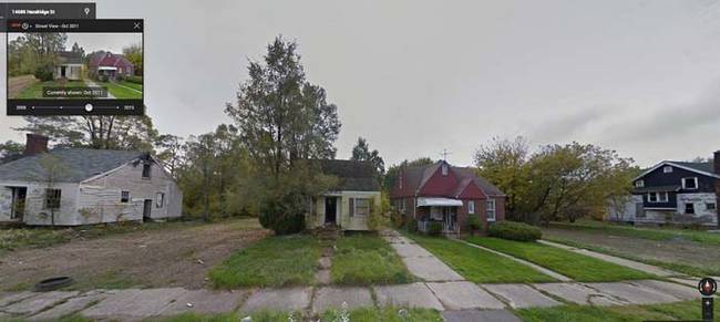
Hazelridge Street – 2011.
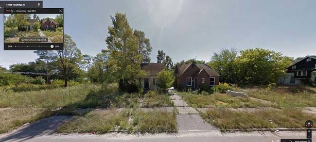
Hazelridge Street – 2013.
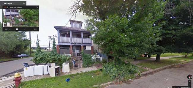
Thaddeus and Leigh Street – 2007.
Thaddeus and Leigh Street – 2009.
Thaddeus and Leigh Street – 2011.
Thaddeus and Leigh Street – 2013.
Eastwood Avenue – 2008.
Eastwood Avenue – 2009.
Eastwood Avenue – 2011.
Eastwood Avenue – 2013.
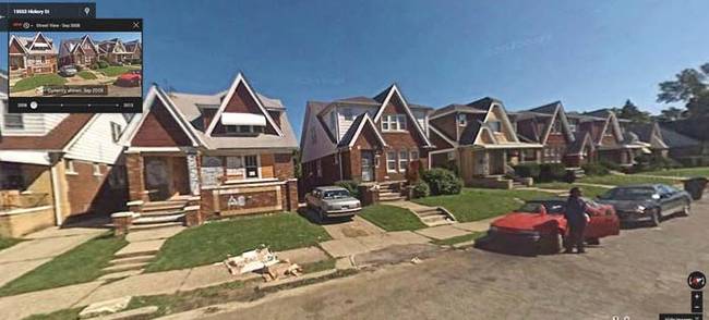
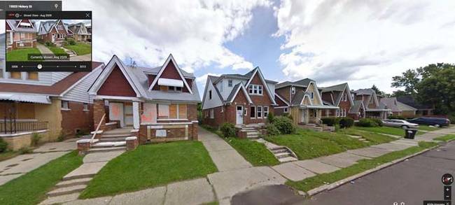
Hickory Street – 2008.
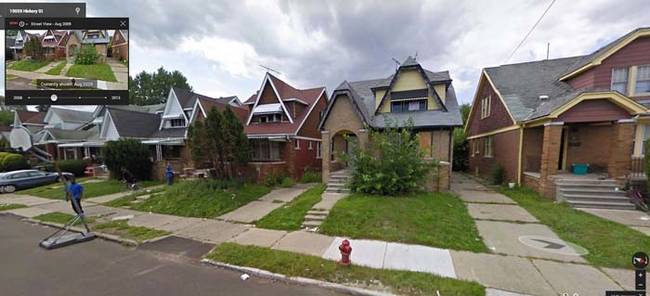
Hickory Street – 2009.
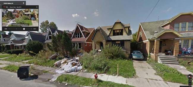
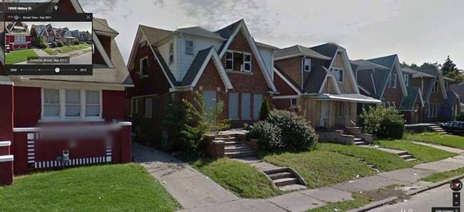
Hickory Street – 2011.
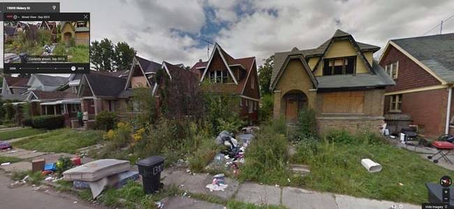
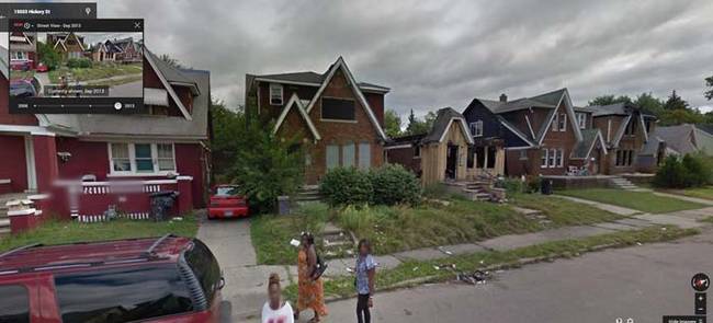
Hickory Street – 2013.
Hickory Street – 2008.
Hickory Street – 2009.
Hickory Street – 2011.
Hickory Street – 2013.
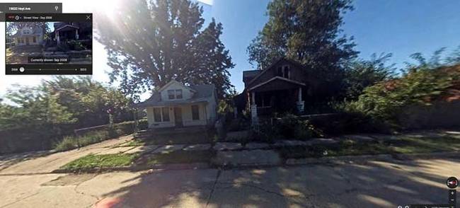
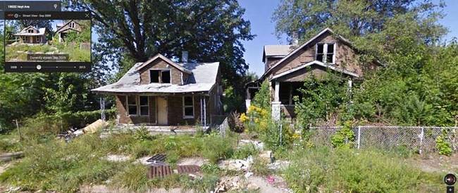
Hoyt Avenue – 2009.
Hoyt Avenue – 2009.
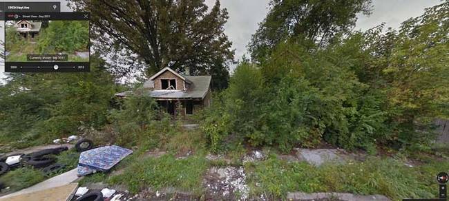
Hoyt Avenue – 2011.
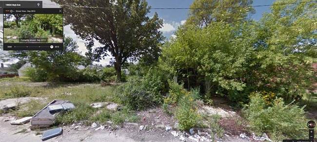
Hoyt Avenue – 2013.
Via: Imgur
The saddest part about these images of decaying Detroit is that it’s only one of many cities in the U.S. facing this problem. While progress is being made in parts of the country to fight urban decay, just as many other places are not doing enough to stop it. That does not bode well for the future…
 share
share
 share
share
 share
share
 share
share
 share
share
 share
share
 share
share
 share
share
 share
share
 share
share
 share
share
 share
share
 share
share
 share
share
 share
share
 share
share
 share
share
 share
share
 share
share
 share
share
 share
share
 share
share
 share
share
 share
share
 share
share
 share
share
 share
share
 share
share
 share
share
 share
share
 share
share
 share
share
 share
share
 share
share
 share
share
 share
share
 share
share
 share
share

